Conveying a Local Civic Issue via Spatially Distributed Public Visualization Displays
How can people convey open urban data in public space?
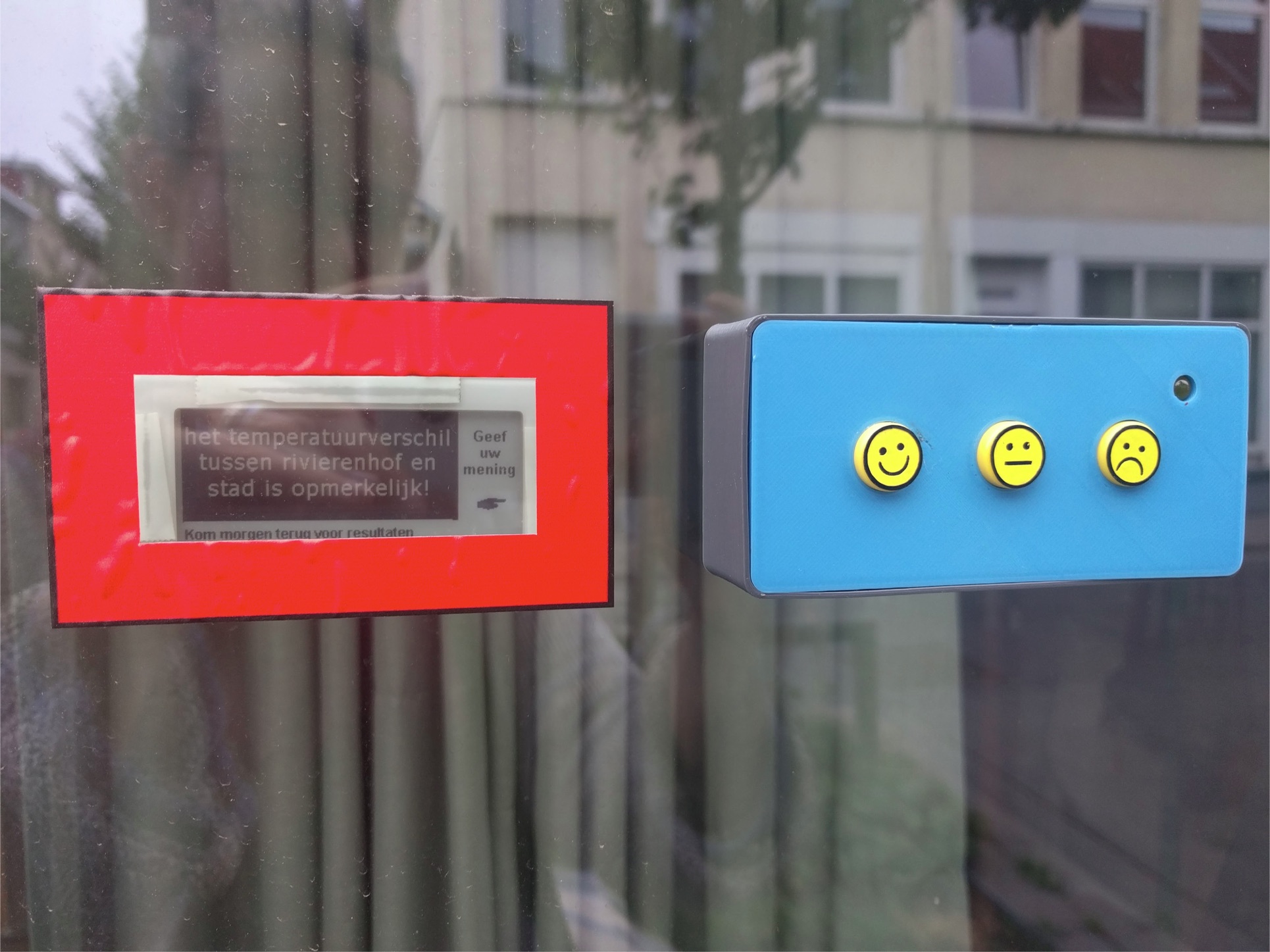
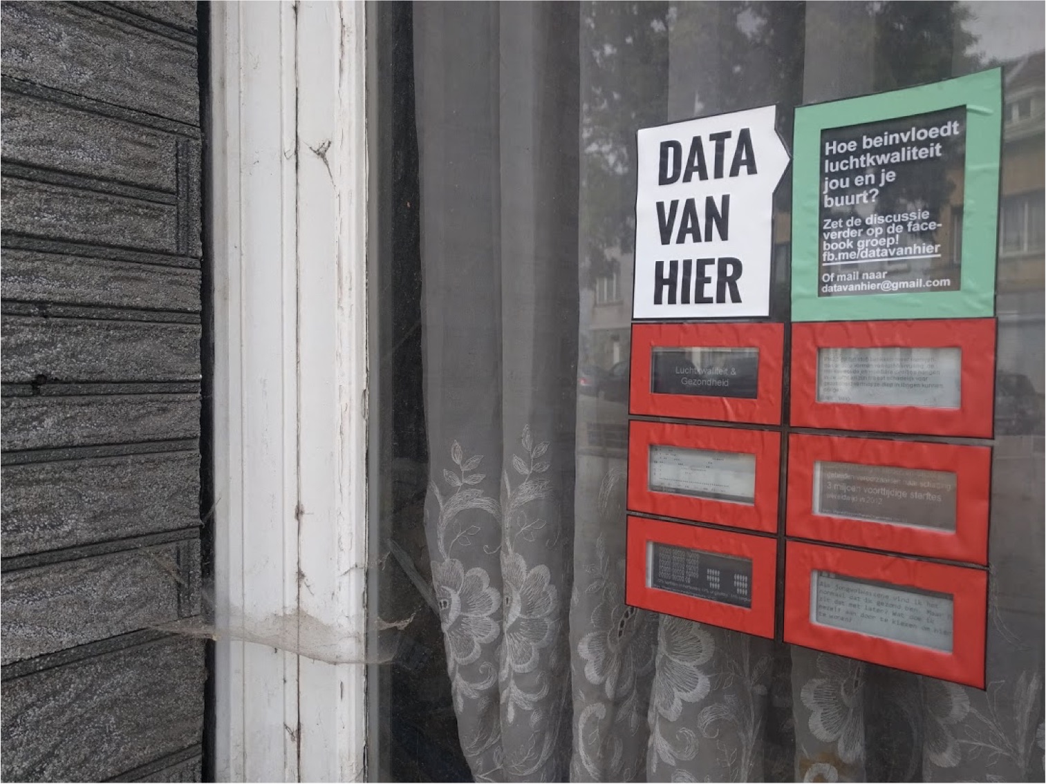
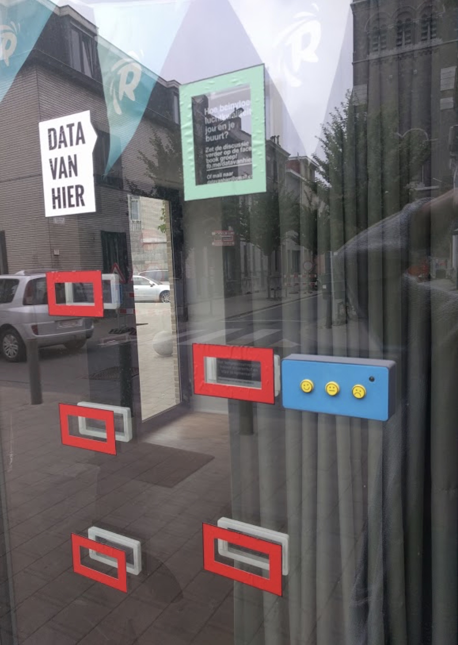
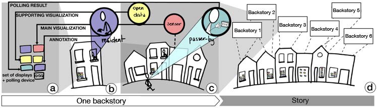
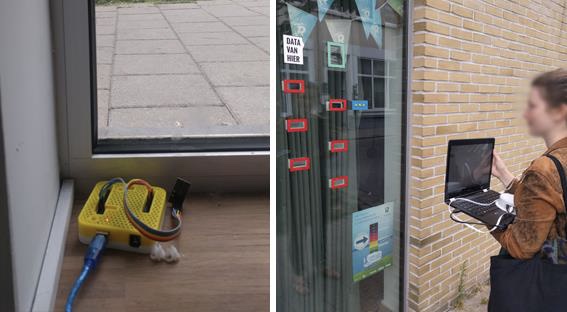
We deployed a public visualization and polling system that enables citizens to co-author a civically-motivated narrative through sensor data. We facilitated that allowed citizens to distribute this data over multiple wireless displays that were located at different locations in the same street.
Through the in-the-wild study methodology, we studied how passers-by and residents engaged with this system. We applied a user engagement evaluation model that maps the social and spatio-temporal context into interactions between the content, the environment and the infrastructure and two distinct user types, i.e. the residents who hosted the displays and the passers-by. Our findings show how the tacit social relationships between the different user types, the social factors between passers-by, various temporal aspects, and several contextual factors affected with how the user engaged with our spatially distributed public visualization and polling displays.
Publication
Sandy Claes, Jorgos Coenen, and Andrew Vande Moere. 2018. Conveying a civic issue through data via spatially distributed public visualization and polling displays. In Proceedings of the 10th Nordic Conference on Human-Computer Interaction (NordiCHI ’18).